Search found 53 items for:
ANNEX H-4
Pingo Canadian Landmark Site
In the Northwest Territories:
in the District of Mackenzie:
in the Mackenzie Delta;
All that parcel of land more particularly described as follows: all topographic features hereinafter referred to being according to edition 1 of the Mackenzie Delta map sheet number 107C of the National Topographical System, produced at a scale of 1:250.000 by the Army Survey Establishment, Royal Canadian Engineers, at Ottawa;
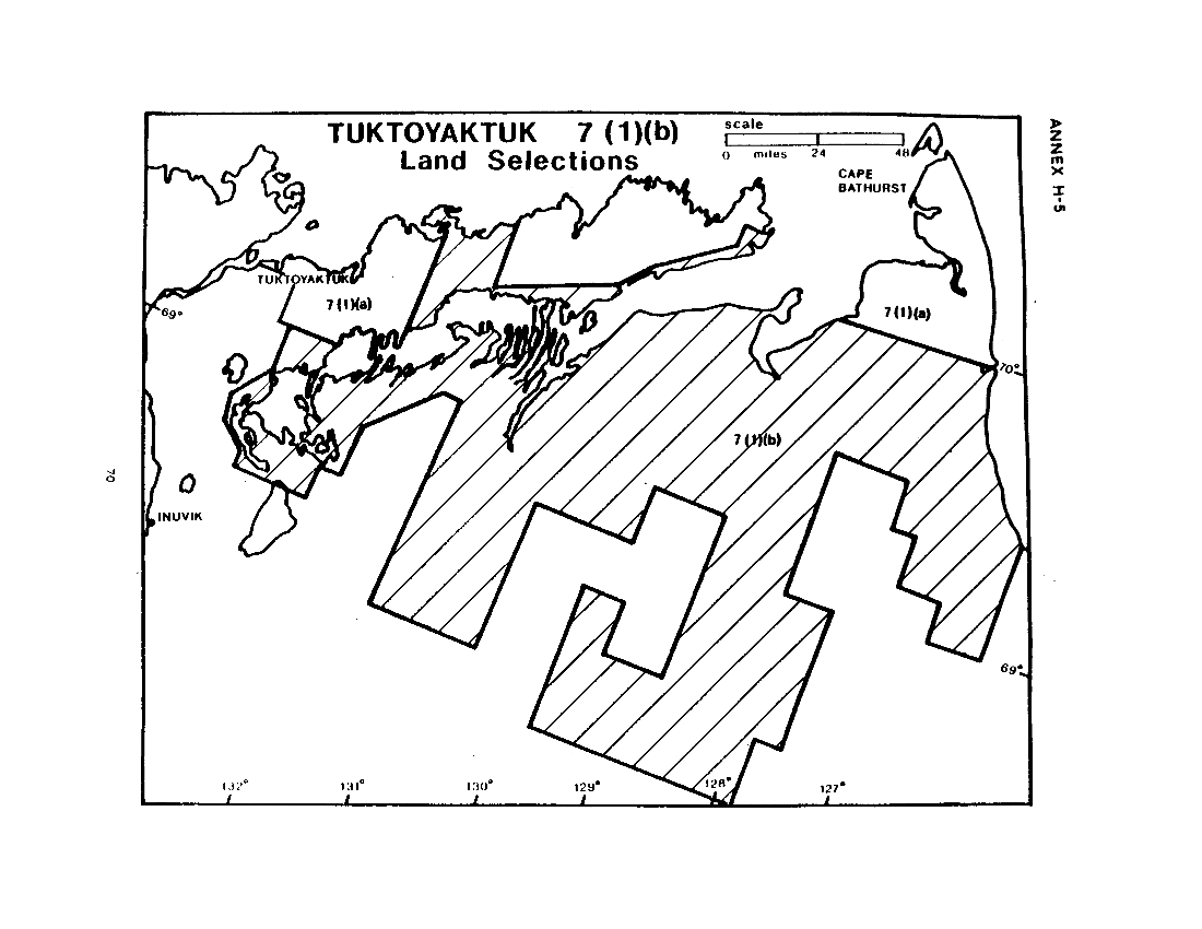
ANNEX H-6
Tuktoyaktuk7(1)(b) Land
In the Northwest Territories;
in the District of Mackenzie and the District of Franklin;
![Paulatuk <a href=]() 7(1)(a) Land Selection (map)" src="/sites/default/files/annex_i_map.png" style="width: 100%; height: 100%;" />
7(1)(a) Land Selection (map)" src="/sites/default/files/annex_i_map.png" style="width: 100%; height: 100%;" />
ANNEX I-1
Paulatuk 7(1)(a) Land
In the Northwest Territories;
in the District of Mackenzie and the District of Franklin:
In the vicinity of Paulatuk;
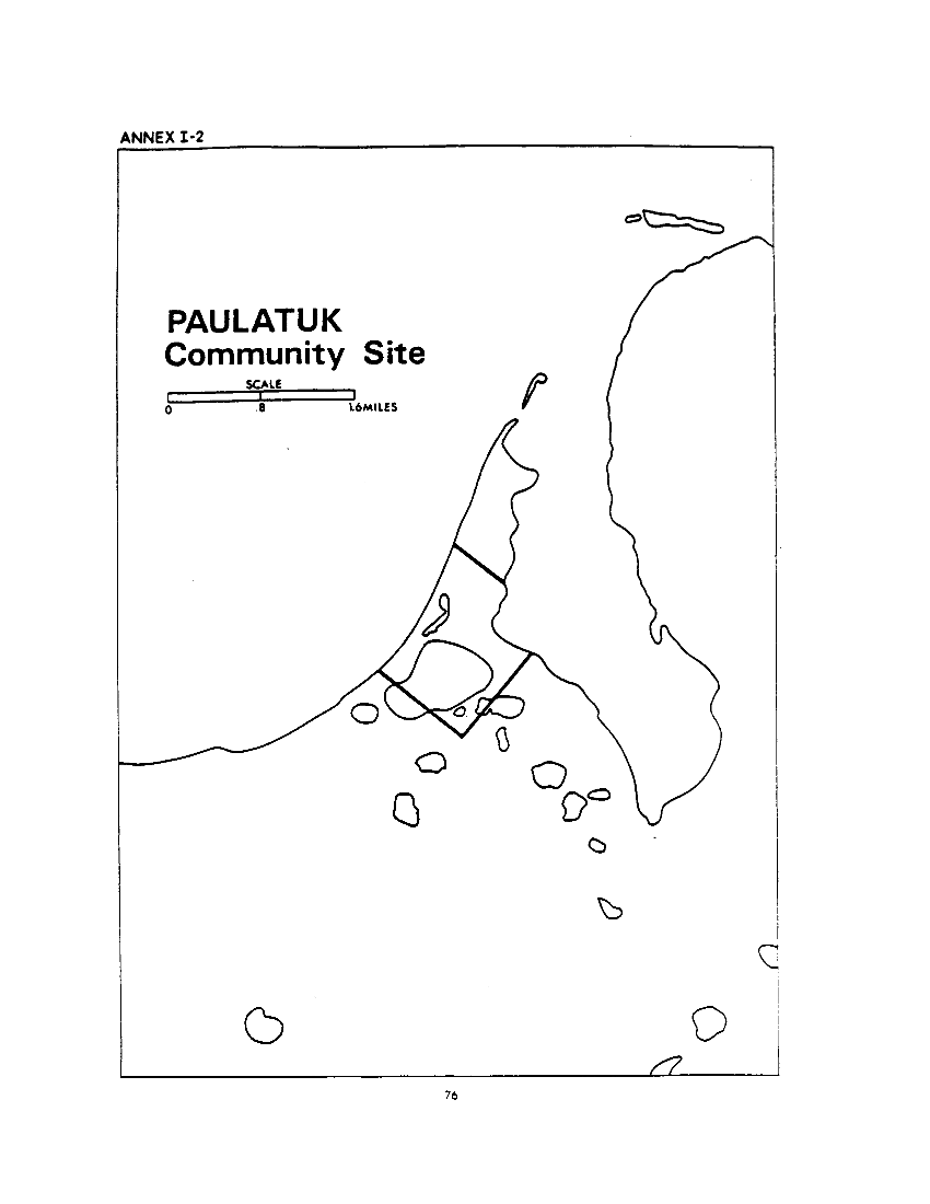
ANNEX I-3
Paulatuk Community Site
In the Northwest Territories;
in the District of Mackenzie;
on Paulatuk Peninsula;
All that parcel more particularly described as follows: ail topographic features hereinafter referred to being according to edition 1 of the Paulatuk map sheet number 97C/8 of the National Topographic System, produced at a scale of 1:50,000 by the Surveys and Mapping Branch. Department of Energy. Mines and Resources, at Ottawa.
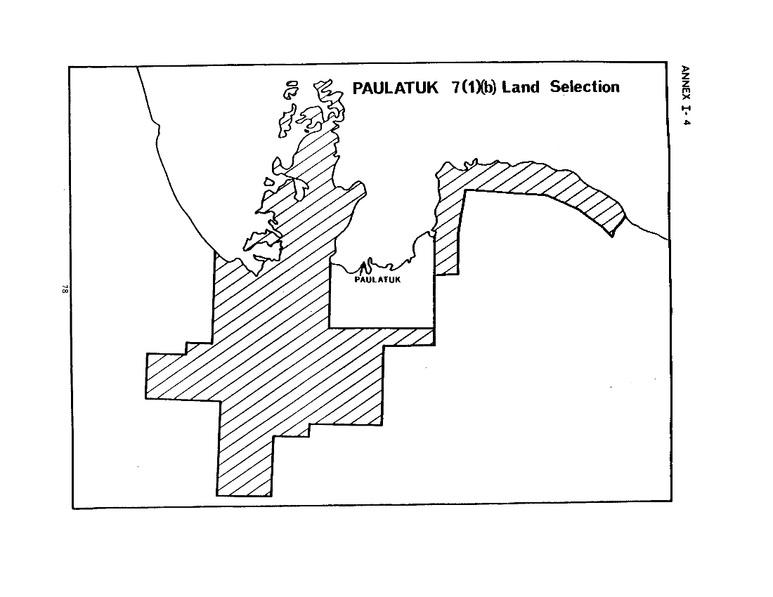
ANNEX I-5
Paulatuk 7(1)(b) Land
(Northeast)
in the Northwest Territories;
in the District of Mackenzie and the District of Franklin;
in the vicinity of Melville Hills;
All that parcel of land more particularly described as follows: all topographic features hereinafter referred to, being according to edition 2 of the Brock River map sheet number 97D of the National Topographic System, produced at a scale of 1:250.000 by the Surveys and Mapping Branch, Department of Energy. Mines and Resources, at Ottawa;
![J. Sachs Harbour <a href=]() 7(1)(a) Land Selection (map)" src="/sites/default/files/annex_j_map.png" style="width: 100%; height: 100%;" />
7(1)(a) Land Selection (map)" src="/sites/default/files/annex_j_map.png" style="width: 100%; height: 100%;" />
ANNEX J-1
Sachs Harbour 7(1)(a) Land
In the Northwest Territories;
in the District of Franklin;
on Banks Island;
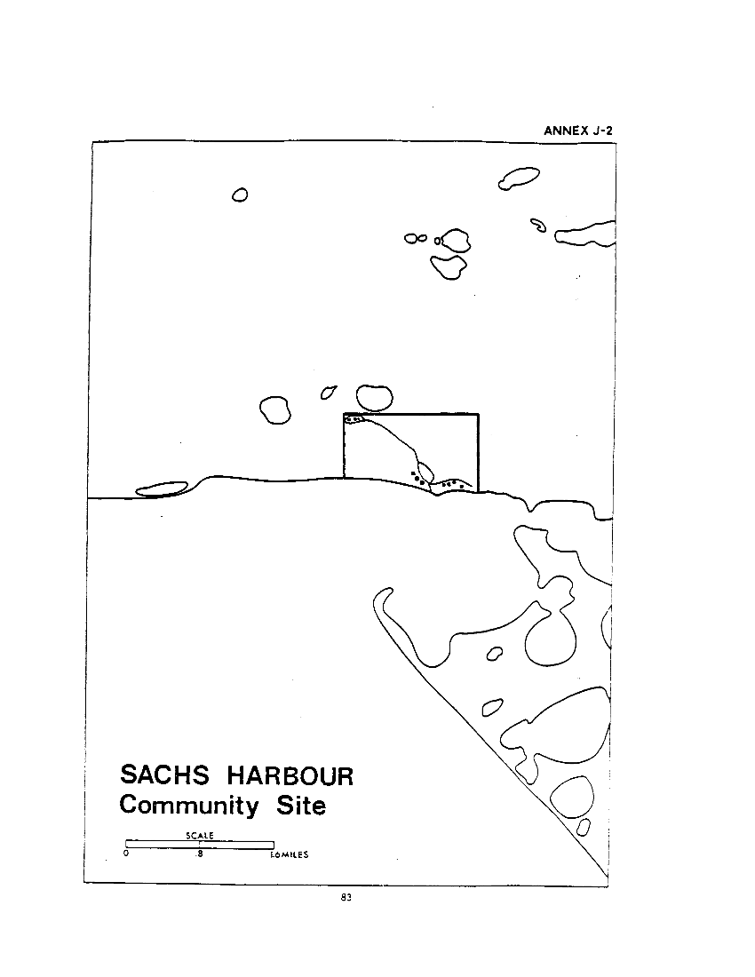
ANNEX J-3
Sachs Harbour Community Site
In the Northwest Territories;
in the District of Franklin;
on Banks Island at approximate latitude 71°59'N. approximate longitude 125°15'W:
All that parcel of land more particularly described as follows:
Beginning at a Canada Lands Surveys '69 pattern post numbered G1579 27L1 1970 according to Plan 56807 in the Canada Lands Surveys Records at Ottawa, a copy of which is filed in the Land Titles Office at Yellowknife as 685;
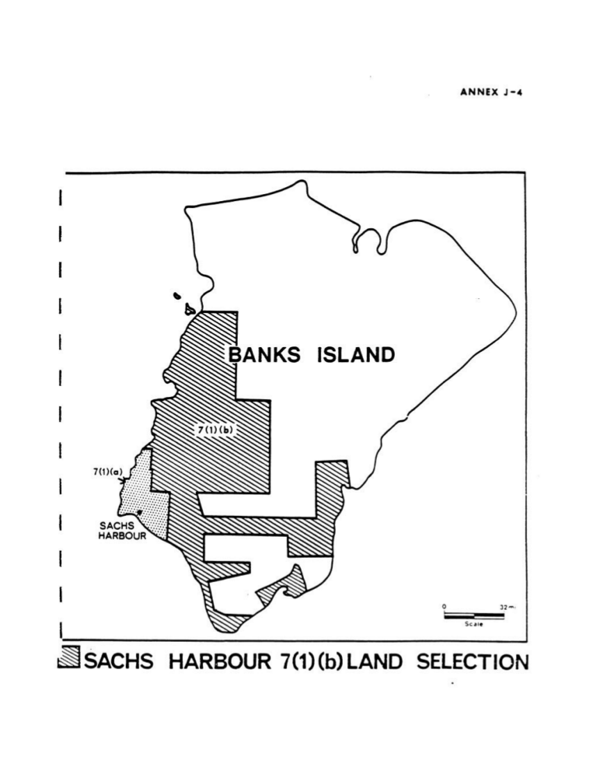
ANNEX J-5
Sachs Harbour 7(1)(b) Land
(Main)
In the Northwest Territories;
in the District of Franklin;
on Banks Island;
![Proposed Nelson Head <a class=]() Canadian Landmark Site (map)" src="/sites/default/files/annex_j7_map.png" style="width: 100%; height: 100%;" />
Canadian Landmark Site (map)" src="/sites/default/files/annex_j7_map.png" style="width: 100%; height: 100%;" />
![Holman <a href=]() 7(1)(a) Land Selection (map)" src="/sites/default/files/annex_k_map.png" style="width: 100%; height: 100%;" />
7(1)(a) Land Selection (map)" src="/sites/default/files/annex_k_map.png" style="width: 100%; height: 100%;" />
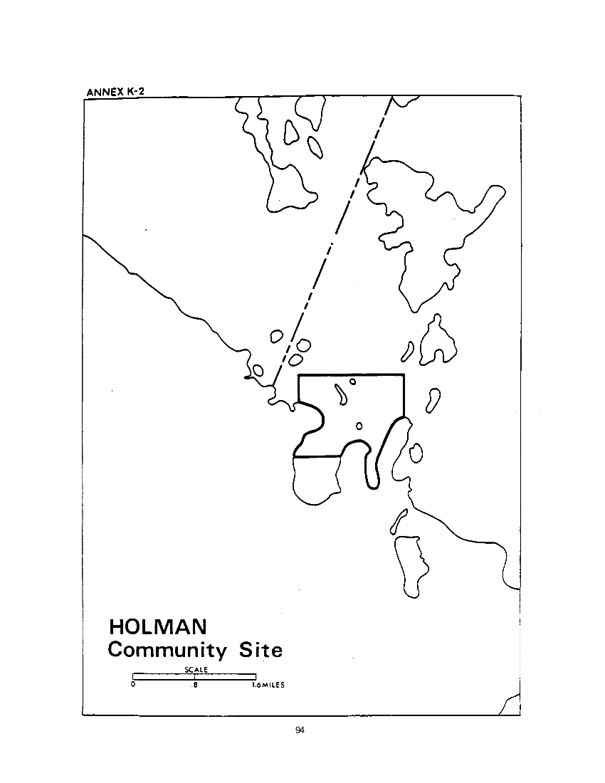
ANNEX K-1
Holman 7(1)(a) Land
In the Northwest Territories;
in the District of Franklin;
on Victoria Island;
All those parcels of land on Diamond Jenness Peninsula according to edition 1 of the National Topographic Series Maps of Holman Island — 87F and Walker Bay — 87G. produced at a scale of 1:250,000 by the Army Survey Establishment, R.C.E. at Ottawa, as said parcels may be more particularly described as follows: